- About Uijeongbu
- About Uijeongbu
- Introduction
Introduction

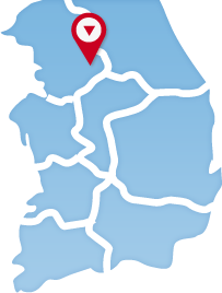
Located in longitude 127°00′∼127°09′ and latitude 37°41′∼37°45′, Uijeingbu is the hub of transport, economy, and culture in the northern part of Gyeonggi-do, South Korea.
Its administrative region is 81.54 km2 wide, including 15 administrative districts. Metropolitan Subway No. 1, Gyeongwon Line, and Pyeonghwa-ro cross the city from north to south. Boasting Mt. Surak in the east, Mt. Dobong in the west, and Mt. Cheonbo in the north, Ujeongbu is a central city in the northern part of Gyeonggi-do that is home to the Gyeonggi Provincial Government North Office and the Second Office of Gyeonggi-do Office of Education, thus being the administrative, cultural, and economic leader in the region.

